I’m on the fabulous, flat-as-a-pancake floodplain near Darley Dale which is framed by hills, most notably the one that props up Riber Castle to the south east and Stanton Moor in the opposite direction.
But it’s cold so I’ve brought out the big guns. That means my buy one pair, get one free Mountain Warehouse ski gloves – it’s the closest I’m going to get to Pyeongchang – and a trusty (tatty) Polartec Extremities thermal hat. I can hardly wait for the hills up to Ladygrove to warm me up.
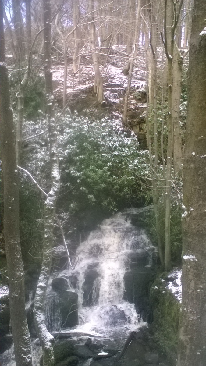
Waterfall cascading down towards Potter Dam at Ladygrove.
Park next to Darley Dale Cricket Club and turn right on to the B5057 towards the Square and Compass pub. Just after, take the right hand squeeze stile for the track down the left hand side of Flatts Farm. It turns into a path which skirts the Derwent then leads you across a train track to Old Road. Turn right, left at the A6 then almost immediately right up Greenaway Lane. Soon after the point where it swings right you’ll see a footpath signed left which will take you past a few houses then into a field. Head diagonally right for the top corner then into a second field where you’re faced with a stiff climb up to Holt Road. On this nippy mid February morning I’ve soon warmed up. There are distinct advantages of having smoked for 25 years (knocked them on the head over a decade ago though) and being chronically unfit.
Turn left on the track at the top and almost immediately fork left on the path down the side of the hill. The astute among you will soon realise that you’ve lost all the height you gained. Sorry about that. There are easier ways of getting to Ladygrove as you’ll see on the map but they are nowhere near as pretty.

View of Sydnope Hall after emerging from Ladygrove.
I’m now at the entrance to an enchanted woodland where the snow adds to the feeling that if I hang around long enough Mr Tumnus is going to appear to rescue me from the White Witch. The path leads past three reservoirs and a couple of lovely waterfalls. It’s a special place. It’s also a bit boggy and there’s a battle through a laurel jungle towards the end but it doesn’t last too long. You’ll eventually emerge at a sturdy bridge which takes you over Sydnope Brook and towards some steps which some helpful soul has put in to get you up the hill towards the hall.

Nests in birch tree on eastern edge of Halldale Wood.
Aim for the left of the farm after this brief scramble. A jitty takes you past Sydnope Lodge and back onto the B5057. Turn left then right after a good 100 yards up Butcher’s Lane, signposted kennels. Turn right at the top onto Back Lane and – just past the kennels – look out for a big metal gate on your left. There used to be a sign indicating that it led to a concessionary path but it’s probably been ripped down by a rambler-hating numpty. Head straight down the field almost directly west towards the edge of Halldale Wood. Look out for the silver birch decorated with dozens of old nests. You’ll hopefully spot a couple of stiles which will lead you into the woods and a path that takes you north to a bridge then swings south on the other side of the brook towards Two Dales.
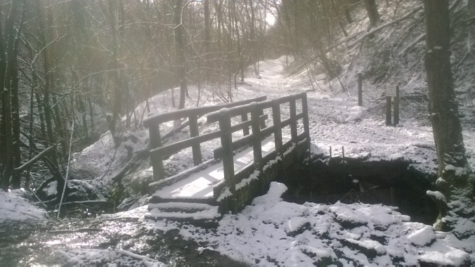
Bridge over the brook in Halldale Wood.
The path eventually turns into a track which finally spills out onto Hallmoor Road. Turn left, then right onto Park Lane and right again for your third and final foray with the B5057. It takes you across the A6 and back to the car park. But the further I walk from the woods, the colder it gets and I wish my dear old ma was around to give me my blankie. Unfortunately, given that she’s been pushing up daisies the top side of 30 years, I am in for a long wait. I must battle on bravely because this is my legacy.
Start: Darley Bridge car park DE4 2JY, SK269623.
Highlight: Floodplain is good and Halldale Wood is excellent but the real star of the show is Ladygrove.
Song: Floodplain? Floodland? Try this – nearly 11 minutes of goth classic.
Lunch: Benches in the woods or back at the cricket ground. Square and Compass is open every lunchtime except Monday – good pub fare.
Distance/map: 6.1 miles, give yourself three hours. OS Explorer OL24 The Peak District/White Peak Area.

OS © Crown copyright [2018] CS-29042-R6R3Z6
